Day 2, Monday:We woke up on Monday to a beautiful Hawaiian morning, with nary a sign that two hurricanes had passed through only days ago; everything was quiet. However, as we were to find out, there actually were two remaining effects on the island. The first was that the storm had completely stopped the usual trade winds; instead of the normal, constant ocean breezes, the air was absolutely, perfectly, still. Without the trade winds, you suddenly remember that you're in the tropics; the day was to turn out extremely hot and muggy. Thankfully, as the week went on the winds came back, but on this first day the exceptionally hot weather made us skip out on a few hikes that we had really been looking forward to.
The second thing was that the storms had completely churned the ocean up. Most lifegaurded beaches were closed to swimming, and all beaches had extremely dangerous surf. Stirred up water also means that the waters were
far from their usual clarity. This also slowly returned to normal as the week wore on, but again it limited us as far as activities went.
In any case, we had plenty of things planned and so headed out for the day. We stopped at Long's Drugs in Kahului for some essentials, and headed toward the infamous "
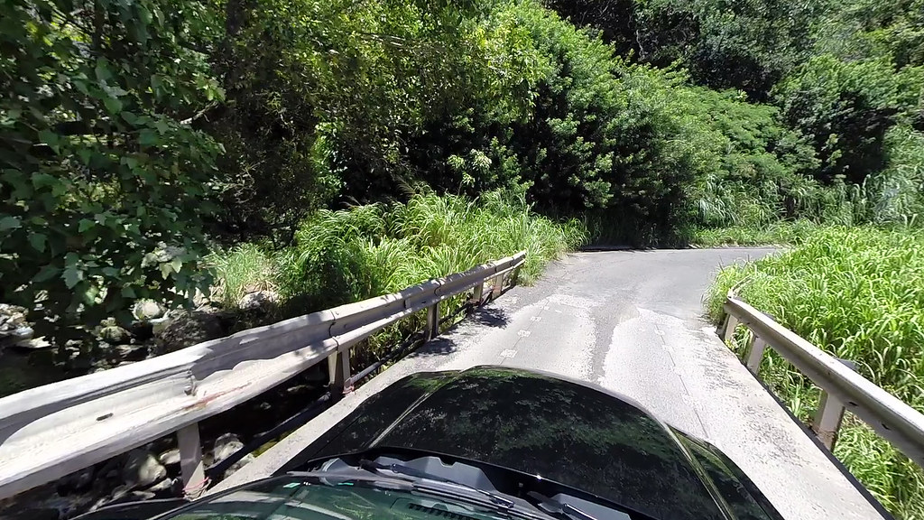
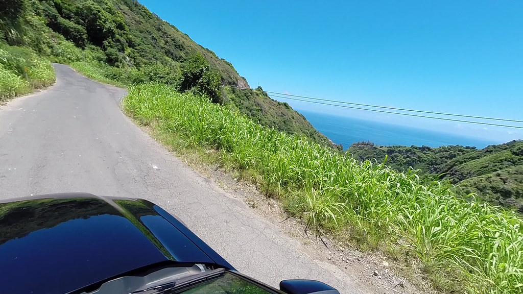
Over the Top" highway. This road follows the northern flanks of West Maui Mountain, and is similar to the Road to Hana, but shorter and less lush. It is also has no traffic, no guardrails, is not completely paved, and has miles of one-lane stretches along sheer cliffs. In short, my dream road

.
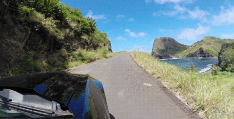
Most people who drive this road (and there aren't many!) drive it from West to East, since this would keep them on the safer inside of the road. We took it East to West, so we were driving along the cliffs most of the time:
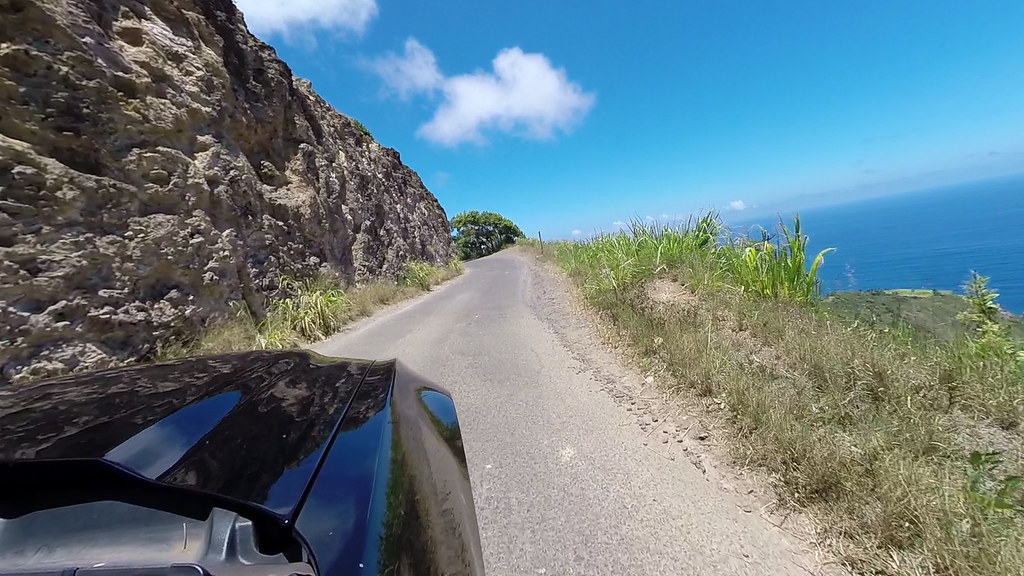
(This picture is a video freeze-frame from a GoPro that was suction-mounted on my side-view mirror, hence the low quality. All other pictures with the nose of the car in it are freeze-frames too.)
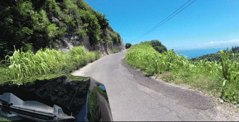
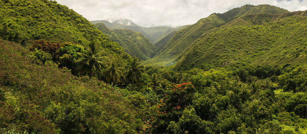
Following the contours of the mountain, the road climbs up and around ridges, hangs on to the edge of the cliff, and slowly meanders down into the jungle valley. Up another ridge, and back down again.
You could see the road cut into the cliff, climbing up and disappearing around the ridge:

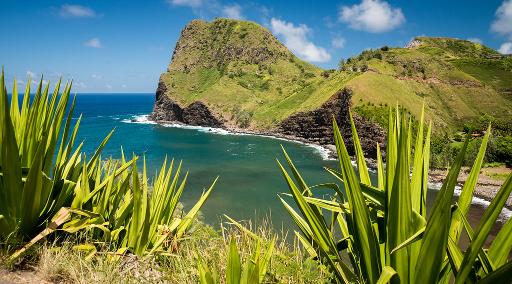
At points the road was a good 500 feet straight up:
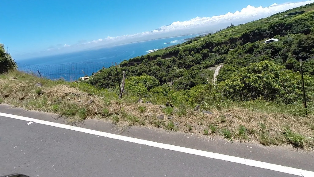
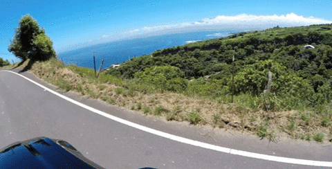
At every turn, in every valley, a different stunning view would appear:


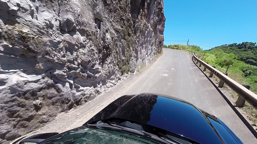
There were many one-way stretches and bridges:
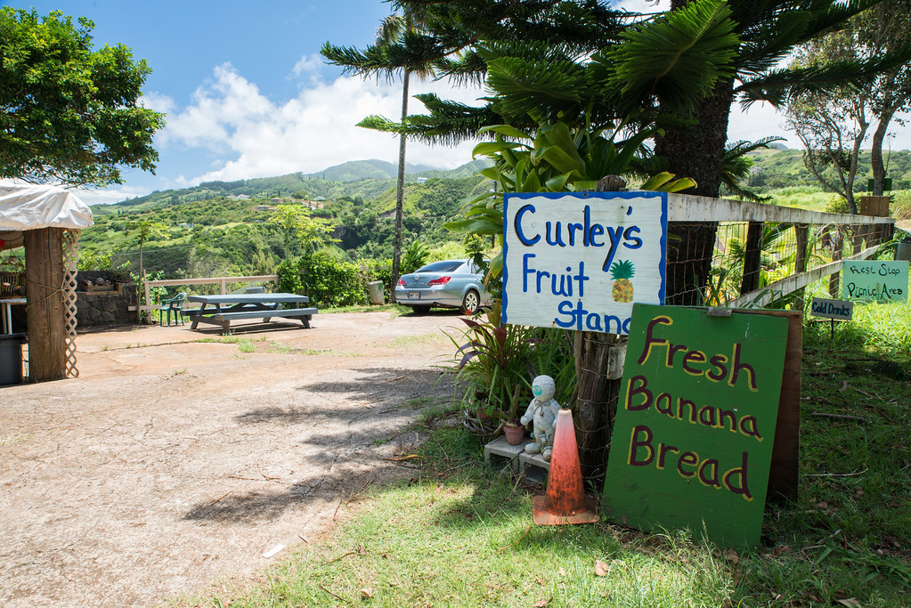
We made a quick stop at
Curley's fruit stand for a quick stretch and picked up some local passion fruit at 25 cents each:
I was driving merrily along on one of the no-guardrail stretches, with nothing but a 12-inch embankment between me and the cliff, when the thing every driver on this road dreads happened: I found myself face to face with a row of cars. Hawaiian etiquette dictates that the driving going uphill should be the one to back up.
Yay, just yay.
Luckily, there was something resembling a turnout a short way behind me, so I didn't have to back very far.

(This GIF is obviously sped up; I did not back down that road
anywhere near as fast.)
We had originally planned on doing the
Waihee Ridge and
Ohai trails, but had to skip them due to the extreme heat caused by the hurricanes. Now having a more open schedule then we had anticipated, we were on the lookout for something different than the typical stops, preferably something with air conditioning

. Our chance was not long in coming - spotting an 8-foot giraffe made out of driftwood on the side of the road, we turned down the driveway to investigate.
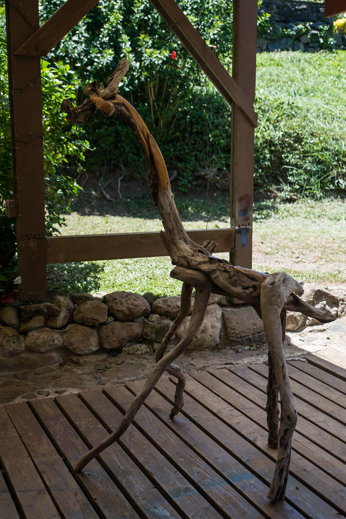
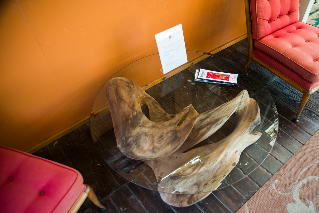
The place turned out to be the
Turnbull Gallery, an eclectic place filled with stunning artwork and sculptures made be local artisans:
"Angel Dance":

The prices were right too; I was sorely tempted:

A cool coffee table:
We spent some time looking around, and had a nice schmooze with Steve, who was working on his latest sculpture in the back.
It was a nice stop, but if you're on this road and the weather is cooperating there's really no reason to stop in - take a hike instead.
On the road again:
More jaw-dropping views around every bend:

And my personal favorite:
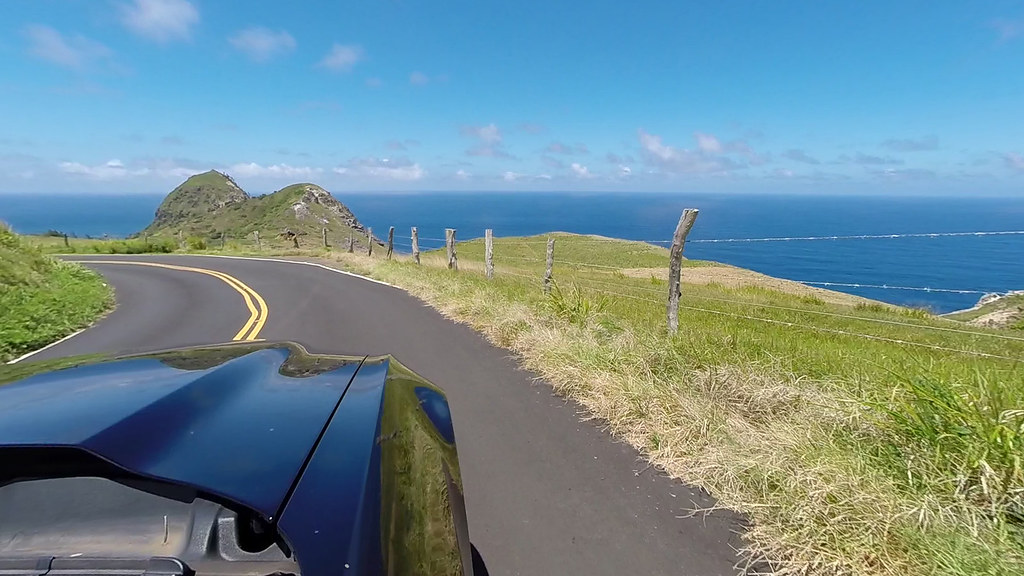
Presently the road opened up a bit as it turned somewhat inland and passed some large ranches:

If you gotta be a cow, I think there's no better place you could hope to live:


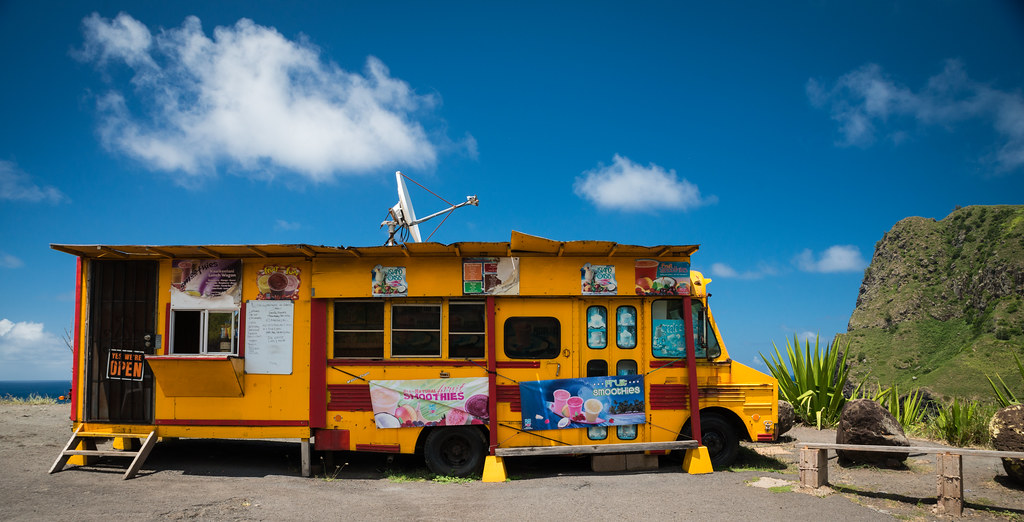
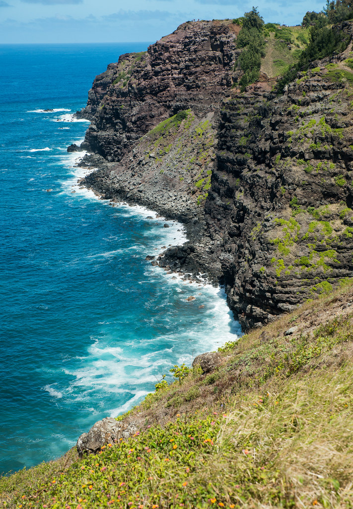
We rounded the famous
Kahakuloa Head (the cows above are actually grazing on the east side of it), and headed up to the other side to a pullout with some amazing views:
On one side of the pullout was the Head:
On the other was the ocean crashing relentlessly against the cliffs:

And in the middle was the oddest ice cream stand you will ever lay eyes on

:
Onward we went to the
Acid War Zone, which would take us to the
Nakalele Blowhole. The description of this hike in
Maui Revealed is fairly accurate, but there are simply too many false trail and tracks for the directions to be very helpful. It's in a spot like this having the companion app is incredibly useful. Simply make sure that you're not straying too far from the blue line and it's impossible to get lost.
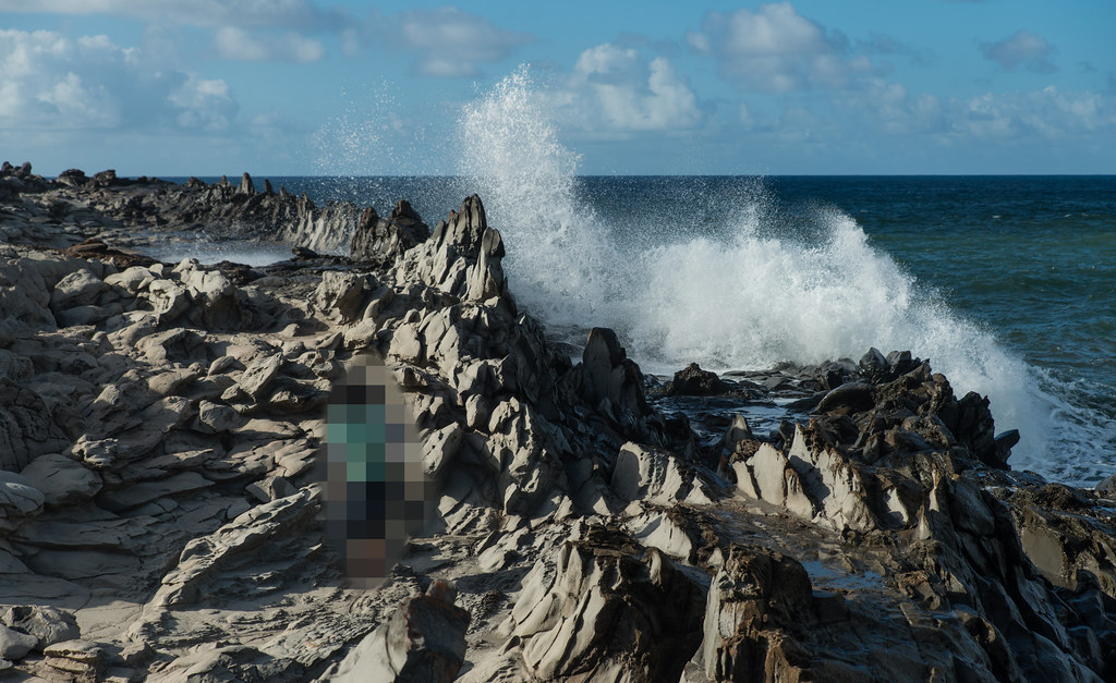
The views from the hike are absolutely incredible.
Note the island of Molokai off in the haze on the horizon:
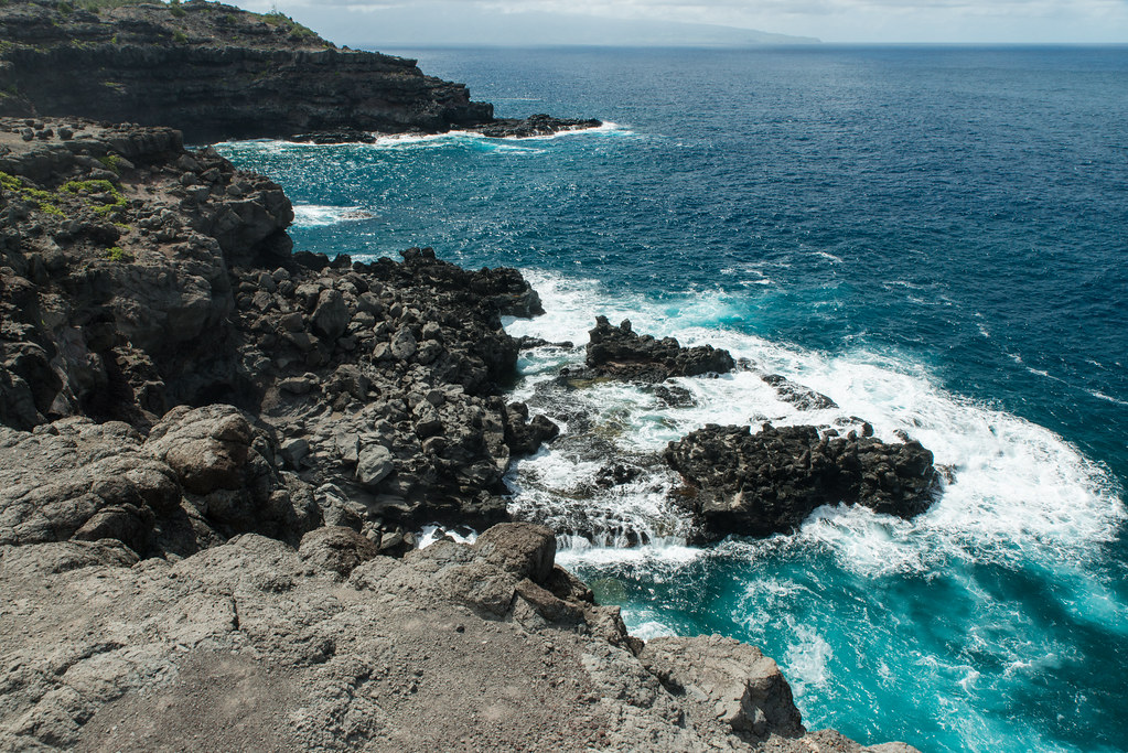
Dangerous and mostly inaccessible tidepools:

You could get some sense of scale from the tiny people perched on top of the cliffs:
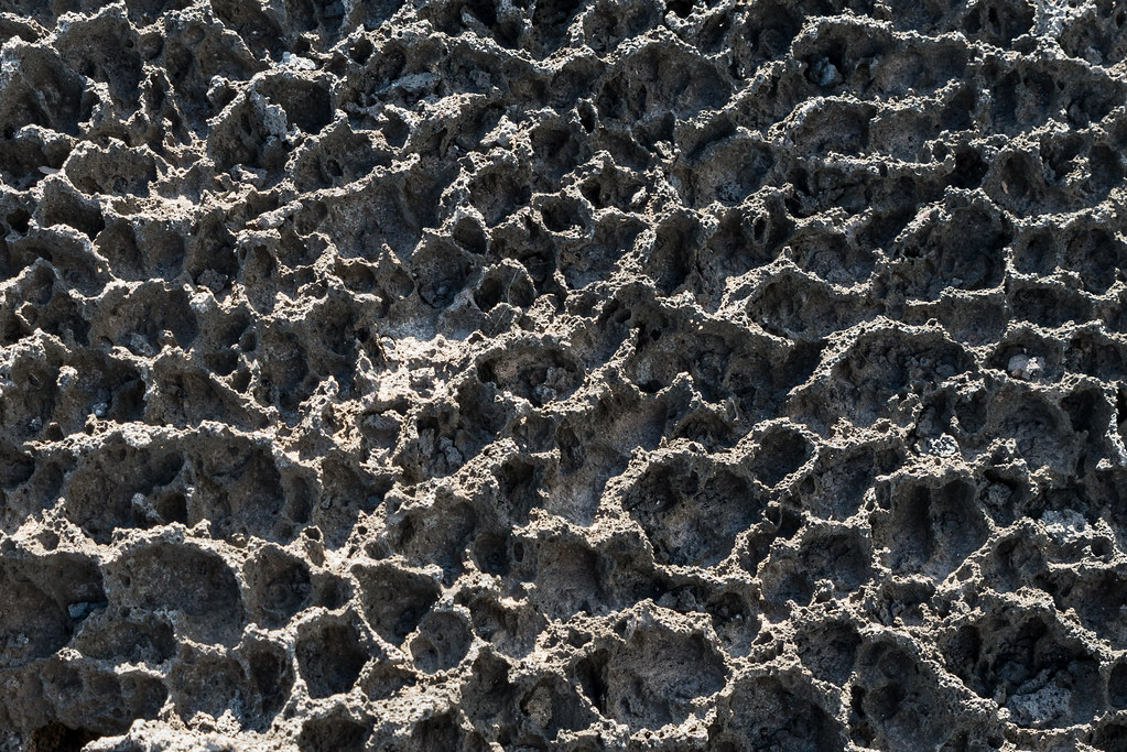
Soon the landscape changes from dry scrubland to the tortured rocks that gave this hike its name - they really do look like they were dissolved by acid. In reality it's the tons of saltwater coming out of the blowhole that's been wearing down these rocks for who knows how long:


Rock detail:
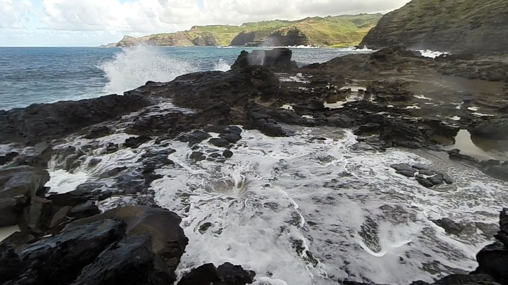
After about half an hour's hiking you get to the blowhole itself. The waves are constantly pushing masses of water in underneath the lava shelf, and every minute or so this water sprays out of a small hole with tremendous force. While I was there the water easily reached a good 60-70 feet every other time. The spray from this column of water reaches dozens of feet all around and was exceedingly refreshing in the stifling heat:
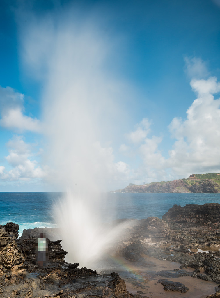
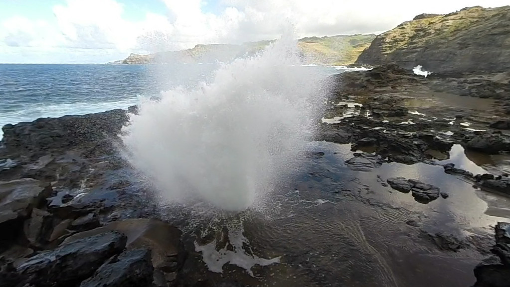
When the burst is over all this water flows back into the hole, creating pretty dangerous conditions. You have to maintain a safe distance, or you could be swept away by the rushing water on the slick rocks:
Here's a video I took, complete with some slow motion footage:
Heading back we took the blowhole trail instead of doubling back through the acid war zone. The trail climbs more than 200 feet over a pretty short distance, and is very steep in parts. Being an out of shape lump, I was pretty winded by the time I got to the parking lot - which was still a 15 minute uphill hike up the road from the acid war zone lot, where my car was parked.
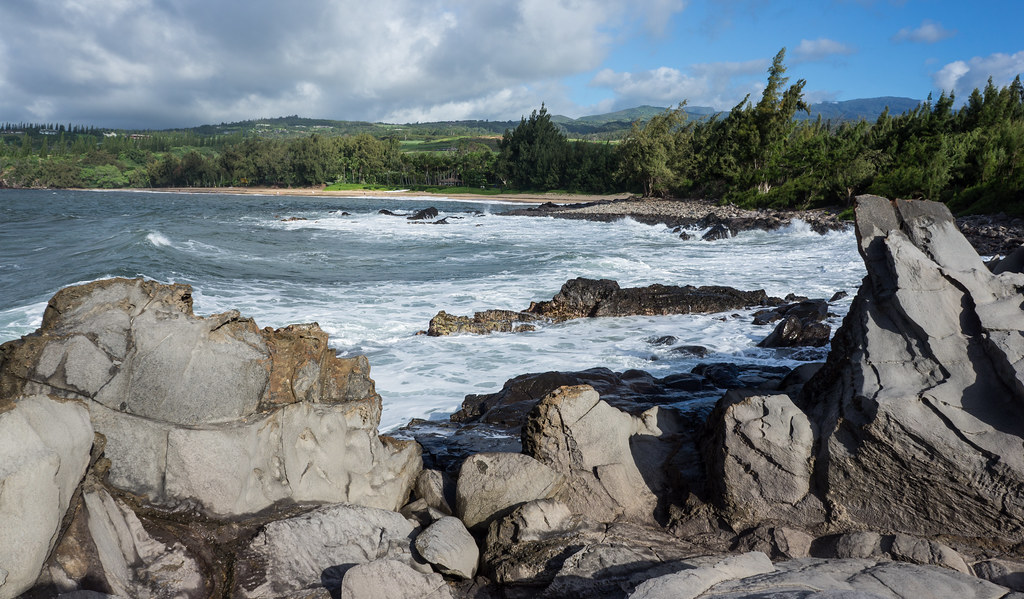
We then headed to the
Dragons Teeth for a quick hike, where the surf was still going bonkers from the hurricanes:

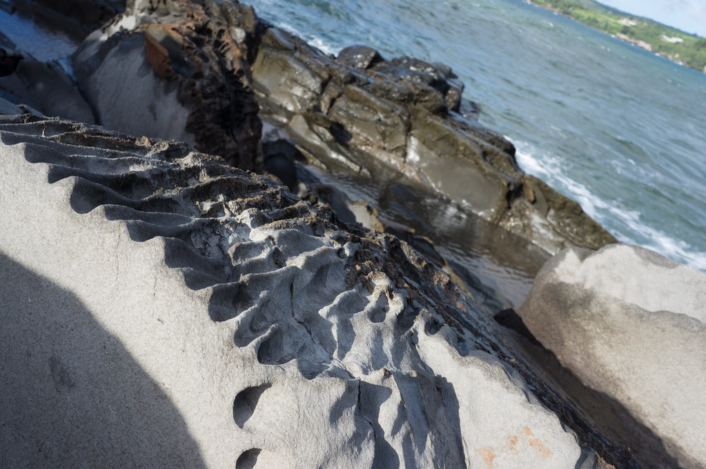
Here, too, the unrelenting ocean had carved interesting patterns in the rocks:
The highway past Dragons Teeth:

By this time it was late afternoon, so we decided to skip our plan of exploring Lahaina. Instead we took the still-under-construction Lahaina bypass around the afternoon traffic. Only part of the bypass was completed and open to traffic, and we didn't come across another soul on the road. The views were stunning, and very different from what we had seen all day. Instead of lush jungle and raging seas, there was the green and brown slopes of West Maui Mountain, lit up by the setting sun:


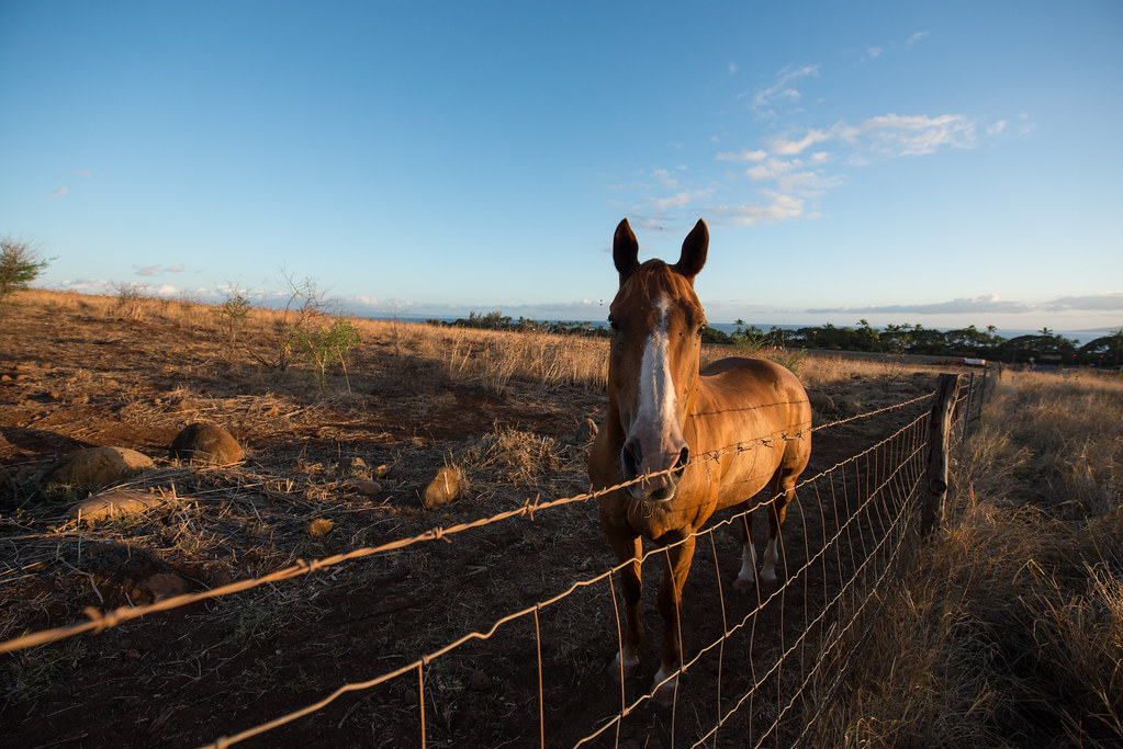
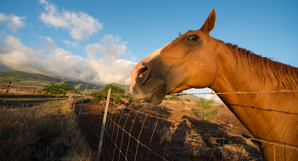
Making a new friend:

I also took a few beauty shots of our car:


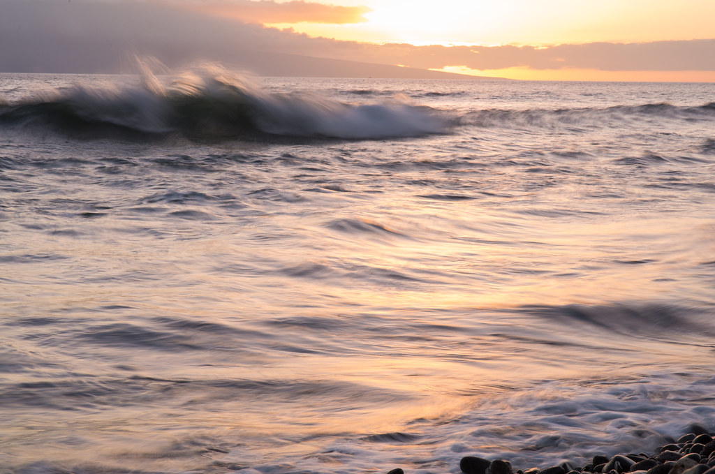
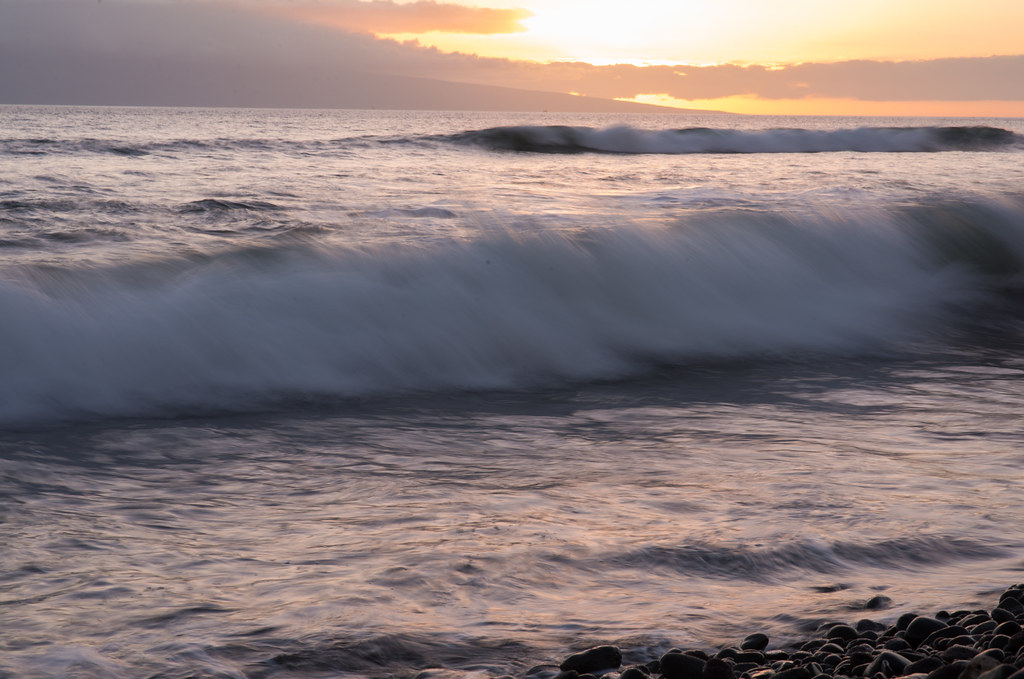
Back on the main road past Lahaina, I stopped for mincha. And just in case we hadn't seen enough beauty that day, we were treated to another incredible Maui sunset:

Then it was back in the car for the long drive back home.
 Topic Wiki
